Tag: RIPA
-

East Harlem, Underwater
With climate change predicted to bring more flooding, heavy rains, storms, and more, it’s important to think about how vulnerable your home/apartment/block/community is. This map, showing flood zones in 2012 (essentially shows the flooding caused by Sandy): The following map, however, shows what a Sandy equivalent storm will do to our coastline in 2080: And…
-

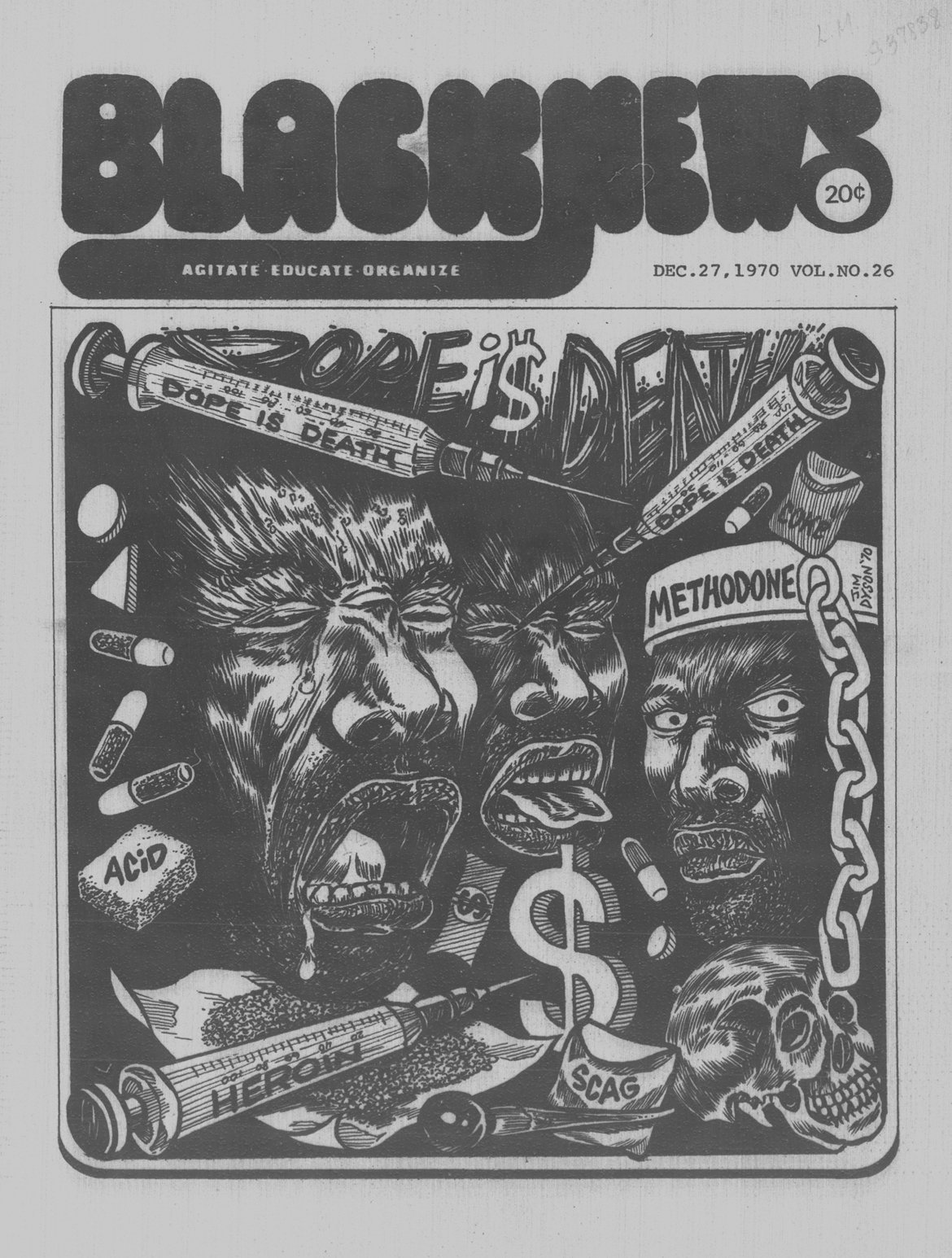
Eric Adams Visits Lex/125
https://fb.watch/bu98DNspEf/ A History of Methadone and Harlem Across New York City, a certain kind of medicine is administered not in a regular pharmacy or a doctor’s office, but in its own kind of space altogether. Most often, these are brick-and-mortar locations, clustered in lower-income communities of color; increasingly, such treatment sites are mobile and distributed. In…
-

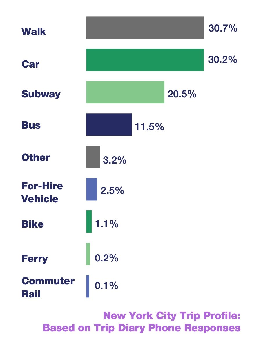
New York City Remains a Transit (and Walking) City
Mode share varies greatly across the city, but New York continues to be a place of sustainable travel. With the exception of eastern Queens and Staten Island, the majority of trips taken by residents are made by a sustainable mode, such as walking, transit, or cycling. Sustainable mode share is as high as 85% in…
-

2020 Census Data on Hispanic New Yorkers
A view of Zip Code 10035 from the 2020 Census. You can see that over the last 30 years, the percentage of Hispanics went down from 62% to 54% – still the largest group by far, in this zip code. In this map of northern Manhattan (above) you can see the grayer areas where the…
-

NBT Dedication
Barbara Ann Teer speaks about the inspiration of her sister in forming and developing the National Black Theater at this groundbreaking dedication clip (click on the chevron pointing right on the text, below) : And to hear more about the devistating fire that (in part) sparked the rebirth of the National Black Theater, see: Randall’s…
-

Asthma+Poverty
Throughout the city, neighborhoods with higher rates of poverty also experience higher rates of childhood asthma, which we can see from the rates of emergency department visits. On the scatter plot below, each dot represents one neighborhood. Its horizontal position represents the neighborhood’s poverty rate, and its vertical position represents its asthma rate. The pattern…
-
As Seen on 2nd Avenue
140% Increase in Visitors to Randall’s Island RIPA (the Randall’s Island Park Alliance) emailed yesterday that the number of pedestrians and cyclists who visited the park, increased by nearly 140% in recent months! Randall’s Island has served as a respite for all who come to walk, run, and bike along its ten miles of safe,…