Tag: Flooding
-

New York City’s Public Health Laboratory Rises
On 137th Street, behind Harlem Hospital, NYC’s new Public Health Laboratory Rises. Scenes from Marcus Garvey Park on Friday
-

East Harlem, Underwater
With climate change predicted to bring more flooding, heavy rains, storms, and more, it’s important to think about how vulnerable your home/apartment/block/community is. This map, showing flood zones in 2012 (essentially shows the flooding caused by Sandy): The following map, however, shows what a Sandy equivalent storm will do to our coastline in 2080: And…
-

Metropolitan Hospital’s Flood Wall Resiliency Project
On May 25, 2022, the New York City Economic Development Corporation (NYCEDC), NYC Health + Hospitals, New York State Division of Homeland Security and Emergency Services Commissioner Jackie Bray, and community members broke ground for a new flood protection system project at NYC Health + Hospitals/Metropolitan in East Harlem. The project includes a perimeter flood…
-

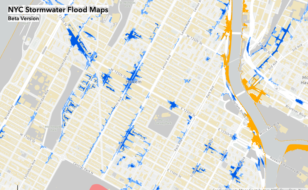
Stormwater
With Ida in many residents’ minds, it’s useful to look at the latest maps of predicted flooding if another hurricane hits NYC. New York City is facing multiple climate hazards that will impact daily life in the City in the future. Coastal storms, heat waves, sea level rise impacts, and extreme rain will strain our…
-

East Harlem + Flooding
The https://welikia.org/ project to visualize the New York area before European explorers and colonists arrives is an incredible resource for anyone curious about the landscape of pre-contact New York. Welika allows you to see how much more ‘pointed’ the lower tip of Manhattan was – jutting out into New York harbor – and how there…