Tag: Randall's Island
-

Randall’s, Ward’s, and Sunken
In 1885, there was Randall’s Island, Ward’s Island, and Sunken Medows, all separated by channels joining the Halrem and East Rivers with Hell Gate and Long Island Sound: The map, for sale on Ebay, shows fascinating details on buildings, orchards, groves, and marshes that are no more: Midnight In Harlem Another white rock group with…
-

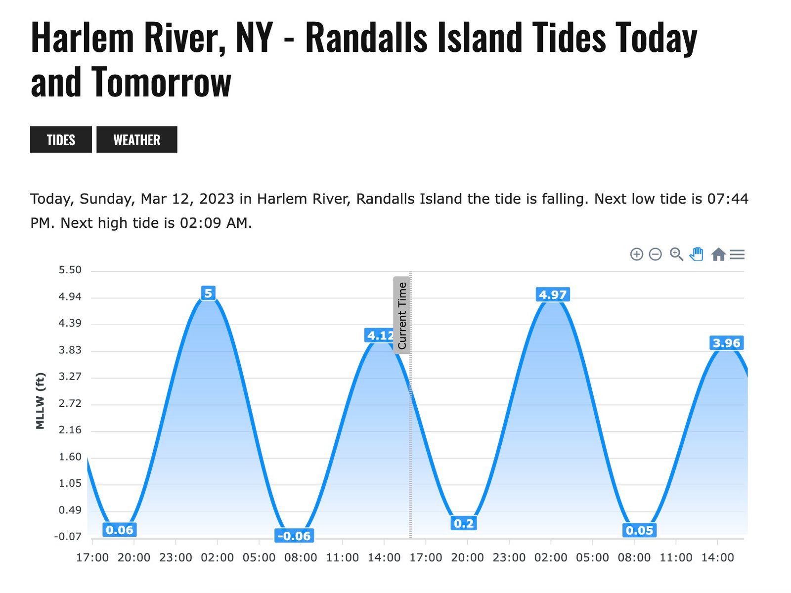
Tides
If you’re headed over to Randall’s Island, and wanted to know if the tide is in or out, here’s your go-to web tool: https://www.boatingworld.com/forecast/harlem-river-ny-randalls-island/tides
-

Eric Adams Visits Lex/125
https://fb.watch/bu98DNspEf/ A History of Methadone and Harlem Across New York City, a certain kind of medicine is administered not in a regular pharmacy or a doctor’s office, but in its own kind of space altogether. Most often, these are brick-and-mortar locations, clustered in lower-income communities of color; increasingly, such treatment sites are mobile and distributed. In…
-

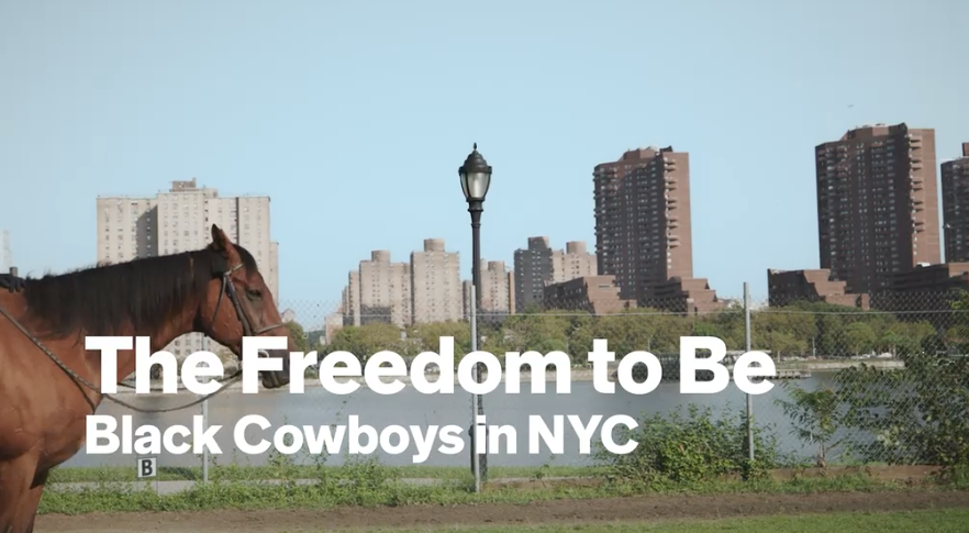
Black Cowboys
East Harlem has a riding center on Randall’s Island that is managed by a storied Black Cowboy. Although more prominent in the South, there is a small but longstanding group of Black cowboys in NYC who have migrated from places like Texas, Virginia and Mississippi. Dr. George E. Blair—a 90-year-old descendant of the buffalo soldiers—who…
-

1936
In 1936, on this day, Jesse Owens qualified for the US Olympic team, running the 100 m trial in 10.4 seconds (note the Ohio top). He also jumped 26′ 3″ in the broad jump, and set a world record for the 200 m race – 21 seconds. What few people know, is that this qualification…
-

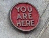
Randalls Island
At the base of the Triborough bridge (where the pedestrian walkway starts in Astoria) there is a wonderful, vintage and cast metal map of Randalls Island: Note the red button on the right-hand side that indicates where you are. Note how Wards Island was not ‘open’ to the public (greyed out) and had a dock…
-
As Seen on 2nd Avenue
140% Increase in Visitors to Randall’s Island RIPA (the Randall’s Island Park Alliance) emailed yesterday that the number of pedestrians and cyclists who visited the park, increased by nearly 140% in recent months! Randall’s Island has served as a respite for all who come to walk, run, and bike along its ten miles of safe,…