Tag: Map
-

Uptown, 1842
In 1842, Manhattan (of course) showed settlement down at the tip of the island, and in a few locations northward. In this view, Harlem is the densest settlement north of 59th Street: Note how West Harlem (Manhattanville, mostly) and East Harlem (then known as just Harlem). were settled, whereas what we call Central Harlem was…
-

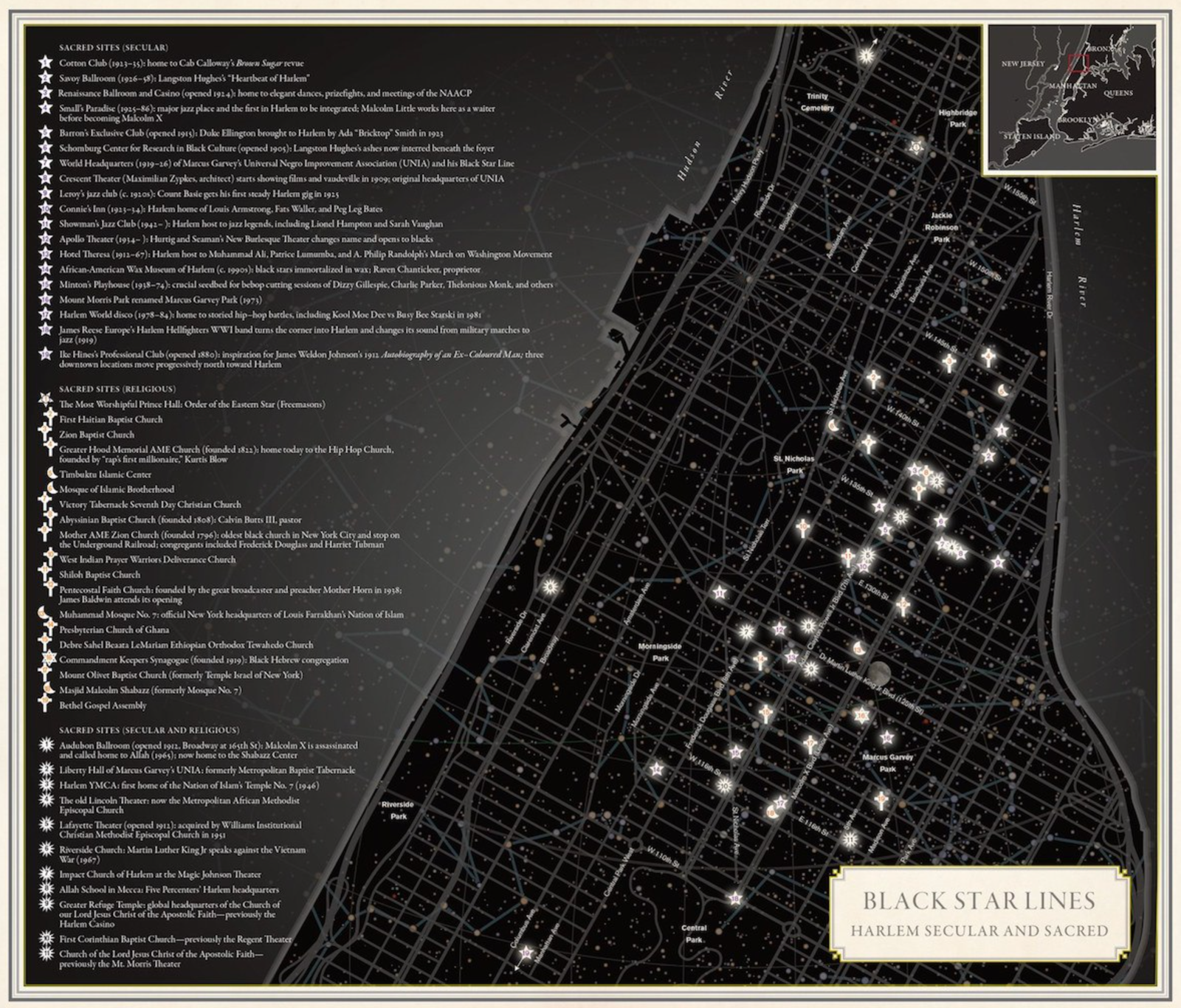
Black Star Lines
A great map of Harlem, showing sites both secular and sacred: Molly Roy, the cartographer, and designer, produced the map in Nonstop Metropolis, a culminating volume in a trilogy of atlases. Her work (she has a number of maps in the atlas) reveals the intimate, ephemeral, and complex experiences of New York City. The larger…
-

Disadvantage
The US Government has a climate and economic justice map of ‘disadvantage’ which looks at census tract information and collates a variety of factors that indicate disadvantage or advantage. The resulting national map is fascinating to explore to not only see where these census tracts are, but the data that underlies the designation. Communities identified…
-

Hue Arts: The Brown Paper
Hue Arts has released a Brown Paper on the experiences and realities of Black, Latinx, Indigenous, Asian, Pacific Islander, Middle Eastern, and all People of Color arts entities. The project seeks to reveal the value they bring to their communities and to the cultural ecosystem of New York City as a whole. Ensuring that arts…
-
Vote!
Enslaved Africans in Dutch Harlem Last year a number of major museums in The Netherlands began to cease using the term “Golden Age” to describe the 17th-century Dutch empire that included New Amsterdam, and the village that became Harlem. In particular, Dutch society has begun to wrestle with fact that much of the power and…