Tag: Commissioners' Plan
-

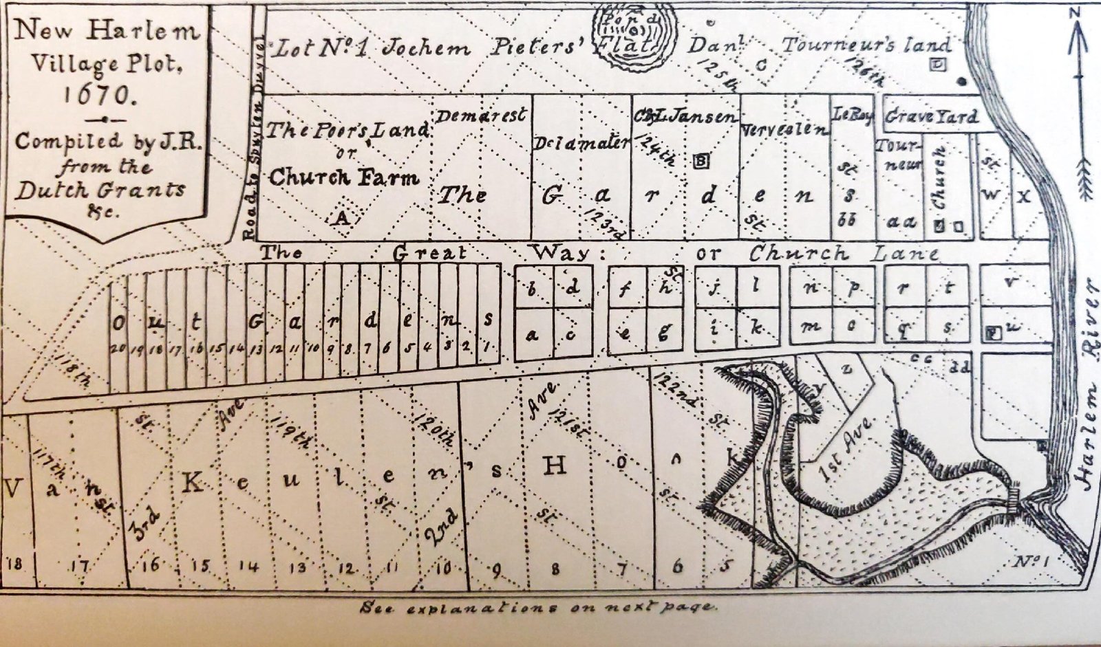
Dutch New Haarlem
A 19th century sketch map of the Dutch colonial settlement of New Haarlem shows a number of interesting features. Notice how the streets are oriented to true north/south, not on a ‘Manhattan-esque’ angle as they are now (based on The Commissioner’s Plan). Also, New Haarlem was centered around 122 and 2nd Avenue, not west along…